CITRIAFORO Operational Group: Use of new technologies for the correct estimation of citrus capacity
- Type Operational group
- Status Filled
- Execution 2022 -2025
- Assigned Budget 489.345,00 €
- Scope Supraautonómico
- Autonomous community Andalucía; Comunitat Valenciana; Murcia, Región de
- Main source of financing CAP 2014-2020
- Project website https://citriaforo.com
Use of new technologies for the correct estimation of citrus yields
Implement Agriculture 4.0 technologies and methods to estimate citrus yields from the plot level to the supra-regional level.
A native mobile application has been developed for Android and iOS (Apple) devices that allows counting fruit on a tree using images taken directly from the mobile device.
Various technologies and programming languages were used in the development of this application, paying special attention to the interface design to ensure ease of use and usability, making the application very simple and intuitive.
The app is primarily composed of two parts. The first includes a user guide with images and examples showing how to take photos to achieve the highest possible quality, as the app's final result depends largely on the quality of these images and following a series of instructions, such as: positioning yourself at an optimal distance, avoiding taking photos facing the sun, setting the camera to the highest possible resolution, etc.
The second part of the application involves sending and processing the images to perform the fruit count and obtain the result, which includes a correction index applied by the algorithm. This algorithm considers various factors such as the fruit variety, image history, and more. Finally, parameters such as fruit size, growth or development curve, and the number of trees or area of the plot to be measured are also taken into account.
- The GO CITRIAFORO project's RD1 dissemination activity consisted of designing a communication plan for effective and efficient internal communication. This task included several actions. These actions allowed for the creation of a corporate image for GO CITRIAFORO with the development of a specific and unique logo for the project. A roll-up prototype was also developed for use at subsequent events where the project was presented, allowing it to be identified and have its own unique stamp. Furthermore, with the development of the database, a list of industry professionals was created, who were informed about the newsletters and kept up to date with the project's progress. With this list, 500 people interested in the project were reached.
- RD2's dissemination activity within the GO CITRIAFORO project consisted of GO CITRIAFORO's participation in events such as scientific conferences, trade fairs, training forums, conferences, etc., in the fruit sector.
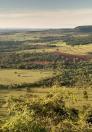
Within this initiative, three types of events were presented: outreach days, agricultural workshops, and attendance at business fairs. All of these activities were successfully completed, reaching the three proposed autonomous communities (Valencia, Murcia, and Andalusia), promoting the innovative project through various presentations throughout its life cycle. One of the initiatives was the agricultural workshops, with the one held by FECOAM standing out. The other consortium members participated in "El Limonar de Santomera," where a practical working meeting was held on the cooperative's farm, and all the technologies generated by the innovative project were demonstrated.
At many of these events in which the project has participated, specific promotional materials generated by the project have been distributed. This material has ranged from tote bags and notebooks with pens to aluminum bottles screen-printed with the project logo, as well as the current regulations that the event must comply with.
We have attended major industry fairs, such as Fruit Logistica and Fruit Attraction, where the project was presented to attendees. At conferences such as DEMOCITRUS, VEGA INNOVA, and EXPO-AGRITECH, the project was even a finalist in the Citrus Innovation Awards at CITRUS-FORUM 2024, Europe's largest citrus event, where you can learn about the latest trends, challenges, and solutions in the world of citrus. - The GO CITRIAFORO project's RD3 outreach activity consisted of generating virtual outreach and communication activities for GO CITRIAFORO. During the project's development, the GO CITRIAFORO website (www.citriaforo.com) was created, divided into different sections where the main project information could be clearly found, along with the option to subscribe to the newsletter, a news section to stay up-to-date on the project, and so on. With the creation of the website, the project generated a newsletter that subscribers received with information related to the project's ongoing outreach activities. Within the framework of the GO CITRIAFORO project, videos were also developed to showcase the project, crop management, and new technologies applied. This has made it possible to raise the profile of the project and publish it on the website. In addition, webinars were held to disseminate GO CITRIAFORO, showing the results obtained and generating videos that served as informative material for inclusion on the website. All this dissemination and communication has allowed the project to become widely known online, reaching a broad segment of the population in different autonomous communities.
The RD4 dissemination activity within the GO CITRIAFORO project consisted of the generation of technical and media publications. All publications aimed to disseminate the opportunities arising from the project's positive results among industry stakeholders and promote its application in business. Technical publications have therefore been published in leading industry journals, such as Levante Agrícola and L'agraria. Furthermore, the project has also been disseminated through media outlets such as the print media. This dissemination has been achieved primarily through press publications, both by the consortium members themselves and in free online and print periodicals. The Levante Agrícola publication can be found in issue 472 of the journal, entitled "Integration of agroclimatic data to improve the prediction of citrus growth curves."
In the case of L'Agraria, the publication entitled "Automatic Systems for Citrus Harvest Prediction" will be published later, in July 2025, and can be found at the following link: https://portalagrari.gva.es/es/formacio-i-transferencia/revista-agraria.
Other links to news stories published in the press can be found in newspapers such as "La Opinión de Murcia," "Freshplaza," "Murcia.com," "Infoagro," and partner websites such as FECOAM and CACV.The RD5 dissemination activity in the GO CITRIAFORO project consisted of monitoring dissemination activities. This monitoring was carried out throughout the project, selecting the target audience, maintaining good internal communication among partners to ensure proper dissemination; monitoring the project website, various publications in partner magazines and newspapers, and the social media accounts of participating partners, generating a list of publications, etc.
The general dissemination formats for this project have focused on virtual, in-person, and publication communication, as discussed in previous PAs.
The project's dissemination plan has been broad and comprehensive, developing at multiple levels, both in terms of materials and target audiences. Once the GO-CITRIAFORO project is completed, it will expand beyond the final conclusions reached, particularly with regard to the use, expansion, and improvement of the various tools developed.
The messages conveyed throughout the project, and what we have always sought to convey, have been to highlight the importance of new technologies and the accurate estimation of citrus yields in Spain. We have provided an overview of the current problems and created opportunities and solutions proposed by the project that can help the citrus sector.
- Developing manual sampling technologies at plot level based on photography with mobile devices.
- Implement automatic sampling technologies at the plot level based on sensors mounted on tractors.
- Implement automatic sampling technologies at the plot level based on sensors embedded in drones.
- Develop cloud-based capacity estimation models at the supra-plot level based on data fusion from the above sources, time series of agro-climatic data and satellite images.
- Mobile app for estimating fruit count at the tree level and protocol for standardizing the acquisition of gauging data using a mobile device.
- Pre-industrial prototype of an image acquisition device for capacity prediction mounted on a tractor or land vehicle.
- Protocol for the standardization of drone-based capacity data acquisition and a management platform for images acquired with ground and air vehicles.
Supra-plot capacity prediction model based on the fusion of information from various sources and the implementation of a digital platform for estimating capacity at different levels.
This result has been achieved through the implementation of a series of algorithms to estimate field performance and the design of a platform for monitoring and managing the data and results of the implemented system.
The developed algorithms consider various parameters to determine, as accurately as possible, the expected yield or production in kilograms from the field, 90 days before the fruit is harvested. This process is particularly complex because, at that time, the fruit is still in an immature, green state, making it even more difficult to identify and count the pieces on the tree.
In addition to counting the number of fruits on the tree, specifically within a selected quadrant, it is necessary to determine the average size or caliber of the fruits. From this size, the unit weight of each fruit can be estimated and then extrapolated, using growth evolution curves, to the expected weight just before harvest.
Finally, the weight obtained, based on the number of pieces, their size, and weight, is projected onto the total number of trees in the evaluated field. This gives us a result in kilograms or tons of total fruit production that the field will yield.
Outcome 3 of Specific Objective 1 has been achieved through the definition and implementation of a protocol specifically designed for collecting data and information to feed the performance forecasting system. This ensures that, both now and in the future, the system can self-improve, increasing its accuracy in delivering performance forecast results.
The protocol considers various parameters such as:
- Cultivation and variety
- Location
- Time of year
- Growth evolution curves
- Historical production data
- Tables of equivalence between calibers and weights
- Fruit counting
- Correction indices
- Plot area
- Number of trees on the plot
All of this data is collected and stored in a database specifically designed to exploit this information on a large scale and use it to improve the system and increase accuracy, reducing the margin of error in the results.
The protocol is implemented both on mobile devices, through an installable app, and on the server, where the algorithms and data models that perform the counting and calculations are hosted, which requires high processing capacity.
The protocol enables the secure and rapid transmission of information between users' mobile devices and servers. Furthermore, scalability was considered during its development, allowing for the integration of other technologies in the future.
A pre-industrial field imaging device has been developed, designed to be mounted on a tractor. It operates autonomously while the driver performs routine agricultural tasks.
Various image capture and analysis systems were evaluated to identify the optimal solution. Using 3D design tools, the structural components required for device assembly were manufactured from plastic.
The system consists of two cameras positioned to inspect both sides of the crop row, a real-time processing unit capable of counting fruit, and a touchscreen with a simple user interface. Power is supplied directly from the vehicle's battery.
Tests confirmed that the most effective algorithms are based on YOLO (You Only Look Once), especially its latest version (v11). To develop real-time decision models, more than 50,000 images of citrus fruits were captured and labeled, covering multiple varieties and lighting conditions, contributing to the model's high robustness.
The device was field-tested in commercial orchards, yielding preliminary results with an accuracy of 80–85% based on the total visible fruit, which corresponds to 60–70% of the actual total count. These results demonstrate the system's potential as a reliable support tool for yield forecasting under real-world conditions.
Objective 1 activities, under Outcome R3, developed a methodology that uses multispectral drone imagery and vegetation index analysis to identify optimal sampling points. This allows farmers to measure fruit yield (number and weight), assess production before harvest, and improve forecast calculations and associated logistics.
Key Results:
• Optimal sampling points improved through soil variability studies and analysis of historical vegetative development.
• High-resolution georeferenced maps for decision-making based on homogeneous areas within the plot.
• Critical periods for drone flights were identified during the campaign, reducing costs by focusing on key growth stages.
Added Value/Benefits:
• Profitability: Fewer drone flights and the ability for farmers to perform them independently.
• Forecast accuracy: Increased accuracy in performance predictions through strategic measurement of performance.
• Precision agriculture: Optimizing water and fertilizer use through mapping of homogeneous areas and guided navigation.
• Increased productivity: Correlation between NDVI data, soil variability parameters, and historical yields to improve crop performance.
Practical Applications:
• Real-time monitoring of crop health and variability.
• Efficient irrigation planning and nutritional management using NDVI data.
• Optimized field operations with georeferenced maps.
This tool promotes sustainability, precision agriculture, and profitability, directly benefiting farmers.
Objective 2 activities, under Outcome R3, enable an intuitive web interface that integrates the optimized point samples resulting from Objective 1. They also enable efficient management and analysis of agricultural data to support decision-making and optimize crop management.
Key Results:
• Georeferenced maps with optimized point samples on farms.
• Data integration that includes zonal soil maps, vegetation indices obtained through drones and satellites, and weather forecasts.
Benefits or Added Values for Farmers:
• Precision Agriculture: Allows for targeted interventions using vegetation indices to monitor crop behavior and moisture levels.
• Reduce costs by focusing on critical growth stages and optimizing inputs such as water and fertilizers.
• Increased Productivity: Facilitates the identification of optimal sampling points and homogeneous areas for better performance prediction.
Practical Applications:
• Real-time monitoring of crop health and variability using interactive maps.
• Crop management planning based on data trends.
• Navigation tools guide users to sampling points or problem areas using GPS integration. Comparison tools allow for parallel analysis of vegetation indices across different dates or treatments.
This platform promotes sustainability, precision agriculture, and profitability by providing farmers with practical information tailored to their specific needs.
A demonstration platform for simulating citrus yield prediction at the supra-orchard scale has been developed, integrated into the project platform, and developed as an interactive application in Google Earth Engine (https://molto-enr.users.earthengine.app/view/citriaforo). This platform demonstrates how large-scale planning and decision-making can be supported by accessible and visual yield estimates.
The platform uses over 3,000 anonymized orchards with scaled data. It predicts total yield based on individual orchard area, agroclimatic variables (radiation, evaporation, air and soil temperature, and precipitation), and Sentinel-2 spectral indices: NDRE (related to vegetation vigor), NDMI (related to water content), and PSRI (related to senescence). The tool can be tested on three varieties. Total yield prediction error is also calculated.
The simulations were trained with reduced data samples (15% if there were more than 700 orchards, 25% otherwise). Ninety percent of the simulations showed total yield errors of less than 10%.
The tool's adaptable design meets the needs of agricultural businesses and organizations, facilitating field planning and yield forecasting. Its open-access implementation encourages knowledge sharing and collaboration among stakeholders.
Outcome 2 of Objective R4 enabled the integration of multiple data sources from other activities into a single visualization platform, improving the user experience for efficient agricultural planning.
Key Results:
- Creation of a digital cloud platform that integrates data from various sources and other project activities (satellite, ground, and air).
Added Value for Farmers:
This result provides farmers with an accessible tool that optimizes their experience by reducing the number of requests and data accesses, improving market competitiveness, and encouraging technology adoption in the citrus sector. It promotes generational renewal and facilitates the inclusion of young people and women.
- Practical Applications for Farmers:
Centralization of harvest forecasting at different levels of data acquisition, facilitating organization and query strategies.
- Coordinator/entity name: AGRO-ALIMENTARIES-CV
- Coordinator/entity email: agro-alimentariescv@agro-alimentariescv.coop
- Asociación AGROTECH España
- Federación cooperatives agroalimentàries de la Comunitat Valenciana
- ANECOOP S.C.
- Productores del campo S.Coop.And
- (ALCAFRUIT)
- Federación de cooperativas agrarias de Murcia
- Greenfield Technologies S.L.
- LOCATEC aplicaciones informáticas S.L.
- Instituto valenciano de Investigaciones agrarias (IVIA)
- Instituto andaluz de investigación y formación agraria
- pesquera
- alimentaria y de la producción ecológica (IFAPA) # Colaboradores: Asociación AGROTECH España
Related projects